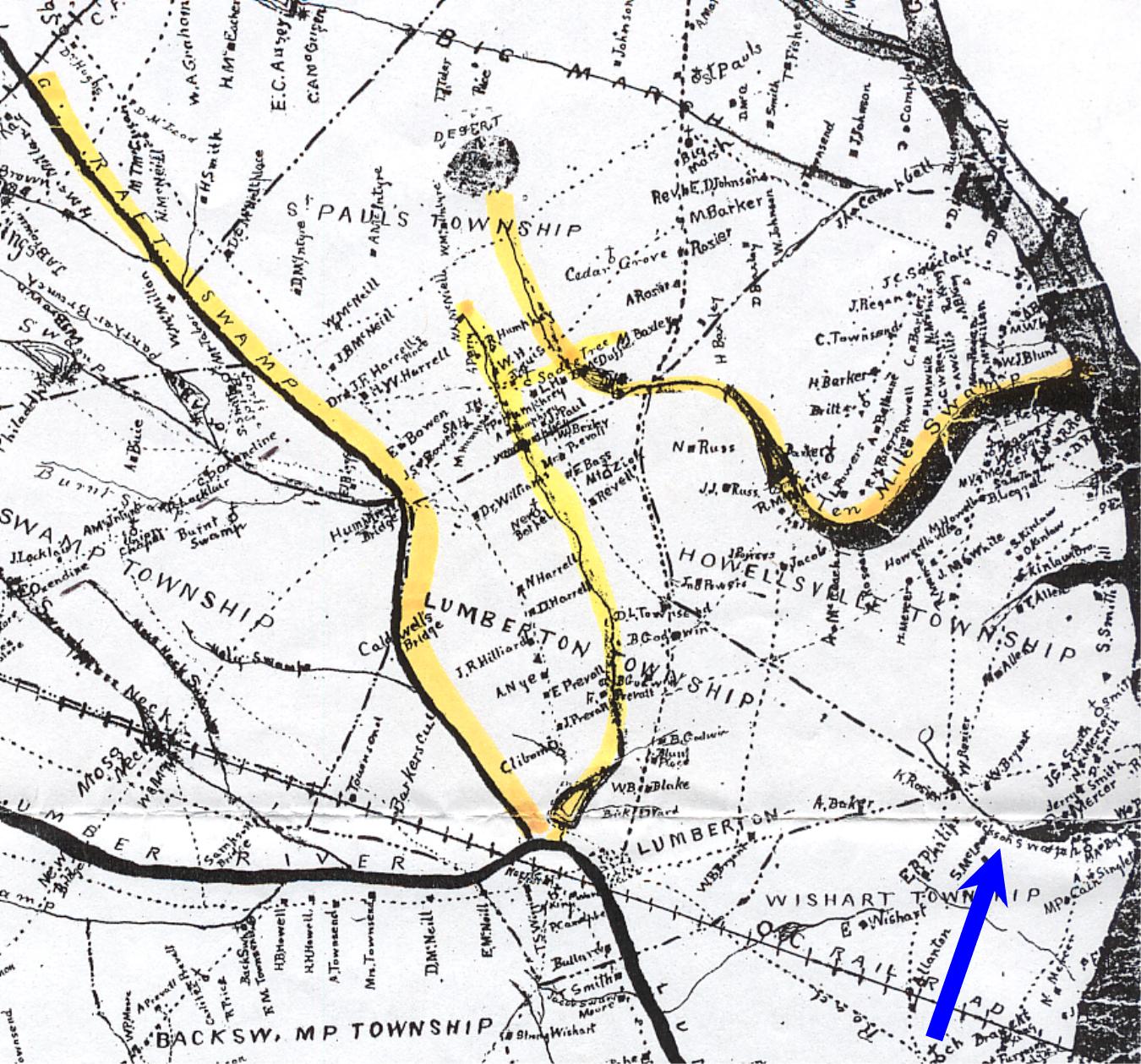
Ten Mile Swamp, Saddletree Swamp and Raft Swamp Areas of Robeson County, NC
Thomas Jackson, Sr. and John Hammonds, Sr. owned land between 1768 and 1811 in the areas highlighted in yellow. This is a map of Robeson County made in 1884. It shows all of the landowners by name. As you can see, there are no Hammonds or Jacksons landowners in the area in 1884. The blue arrow points to a body of water called Jackson's Swamp that may have been named before 1770 for Thomas Jackson or his ancestors.
Map:
1884 Map of Robeson County, NC
by John McDuffie, C.E.
Source:
Map Collection
NC State Government Archives
109 East Jones Street
Raleigh, NC